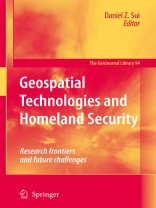
Homeland security and context In the Geographical Dimensions of Terrorism (GDOT) (Cutter et al. 2003), the first book after 9/11 to address homeland security and geography, we developed several thematic research agendas and explored intersections between geographic research and the importance of context, both geographical and political, in relationship to the concepts of terrorism and security. It is good to see that a great deal of new thought and research continues to flow from that initial research agenda, as illustrated by many of the papers of this new book, entitled Geospatial Technologies and Homeland Security: Research Frontiers and Future Challenges. Context is relevant not only to understanding homeland security issues broadly, but also to the conduct of research on geospatial technologies. It is impossible to understand the implications of a homeland security strategy, let alone hope to make predictions, conduct meaningful modeling and research, or assess the value and dangers of geospatial technologies, without consideration of overarching political, social, economic, and geographic contexts within which these questions are posed.
قائمة المحتويات
Geospatial Technologies and Homeland Security: An Overview.- Remote Sensing and GIS as Counterterrorism Tools for Homeland Security: The case of Afghanistan.- Economic Impacts of Terrorist Attacks and Natural Disasters: Case Studies of Los Angeles and Houston.- From Crime Analysis to Homeland Security: A Role for Neighborhood Profiling?.- Measuring and Mapping Conflict-Related Deaths and Segregation: Lessons from the Belfast ‘Troubles’.- Internal Security for Communities: A Spatial Analysis of the Effectiveness of Sex Offender Laws.- Remote Sensing-Based Damage Assessment for Homeland Security.- Estimating Flood Damage in Texas Using GIS: Predictors, Consequences, and Policy Implications.- Agent-Based Modeling and Evacuation Planning.- Building Evacuation in Emergencies: A Review and Interpretation of Software for Simulating Pedestrian Egress.- High-Resolution Coastal Elevation Data: The Key to Planning for Storm Surge and Sea Level Rise.- Remote Sensing and GIS Applications for Precision Area-Wide Pest Management: Implications for Homeland Security.- Spatial Epidemiology: Where Have We Come in 150 Years?.- The Role of Geosurveillance and Security in the Politics of Fear.- Mapping the Under-Scrutinized: The West German Census Boycott Movement of 1987 and the Dangers of Information-Based Security.- The Importance of Spatial Thinking in an Uncertain World.- GIS and Homeland Security Education: Creating a Better Tomorrow in our Classrooms Today.- Geospatial Technologies and Homeland Security: Challenges and Opportunities.


