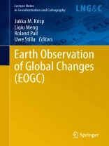
This book provides a collection of selected articles that have been submitted to the Earth Observation and Global Changes (EOGC2011) Conference. All articles have been carefully reviewed by an international board of top-level experts. The book covers a wide variety of topics including Physical Geodesy, Photogrammetry & Remote Sensing, High-Resolution and Fast-Revisiting Remote Sensing Satellite Systems, Global Change & Change Detection, Spatial Modelling, GIS & Geovisualization. The articles document concrete results of current studies related to Earth Sciences. The book is intended for researchers and experts working in the area of Spatial Data Analysis, Environmental Monitoring/Analysis, Global Change Monitoring and related fields.
قائمة المحتويات
Global gravity field models and their use in Earth system research.- Enhanced TEC Maps Based on Different Space-Geodetic Observations.- En MAP Ground Segment Design: An Overview and Its Hyperspectral Image Processing Chain.- Robust Phase-Correlation based Registration of Airborne Videos using Motion Estimation.- Ozone seasonal variation with ground-based and satellite equipments at Évora Observatory – Portugal during 2007-2010.- Detecting and Characterizing Settlement Changes in developing countries using VHSR data – case of the Coastal Area of Benin.- Multispectral remote sensing of invasive aquatic plants using Rapid Eye.
