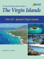
This edition is Part III of The Island Hopping Digital Guide to the Virgin Islands and covers the Spanish Virgin Islands, including Culebra, Culebrita, and Vieques.
The Island Hopping Digital Guides are the digital versions of the world-famous cruising guides written by Stephen J. Pavlidis. Over the past 20 years, Stephen J. Pavlidis has written more than 10 excellent cruising guides covering all of the waters from south Florida to the islands of Trinidad and Tobago and everything in between.
Each cruising guide contains many color charts, photos and loads of current local knowledge making this a must-have guide for yachts planning to cruise the Spanish Virgin Islands. With full-color aerial harbor photos and full-color sketch charts, it contains extremely accurate hydrographic data based on personally conducted independent surveys by the author. This guide also includes extensive navigational instructions, GPS waypoints, approaches and routes, anchorages, services, dive sites, history, basic information for cruising in the Virgin Islands (and Puerto Rico), extensive appendices, contact information and more.
These cruising guides are not only essential for navigation and piloting while cruising , but also for use at anchor or dockside because of the valuable shoreside information they contain. The digital versions also have the added convenience of live links for email and websites to the many services and marinas found throughout the region. In addition, they make excellent planning tools for future adventures.
قائمة المحتويات
Table of Contents
Introduction
The Basics
Currency
Customs and Immigration
Diving In Puerto Rico
Holidays
Hurricane Holes
Language
Phoning Home
Tides and Currents
Weather
Using the Charts
Index of Charts
List of Charts
The Spanish Virgin Islands
Moorings in the SVI
Isla de Palominos
La Cordillera to Isla de Culebra
Isla de Culebra
Isla de Culebrita
Isla de Vieques
Punta Arenas
Punta Arenas to Isabel Segunda
Bahia Icacos to Bahia Salina del Sur
Ensenada Honda to Isla Chiva
Puerto Ferro
Puerto Mosquito
Ensenada Sun Bay and Esperanza
A Little Basic Spanish
Dining in Puerto Rico
References
Appendices
Appendix A: Navigational Lights
Appendix B: Marinas
Appendix C: Service Facilities
Appendix D: Waypoints
Appendix E: Metric Conversion
About the Author
عن المؤلف
Stephen J. Pavlidis has been cruising the islands of The Bahamas and Caribbean aboard his 40′ cutter, IV Play, since 1989. In 1993, he met Ray Darville, then the Warden of the Exuma Cays Land and Sea Park, who drew Steve into a working relationship as a volunteer Deputy Warden. In this role Steve quickly gained an intimate knowledge of the waters of the Park and the Exuma Cays
Realizing that the Exuma Cays Land and Sea Park deserved a bit more recognition than is given in even the best guides to the area, Steve and Ray produced A Cruising Guide to the Exuma Cays Land and Sea Park. The favorable response to that publication led to the publication of The Exuma Guide in 1995, covering the entire Exumas island chain in addition to the Park. The Exuma Guide, has been thoroughly updated for this new edition. Steve has resurveyed the region, updated all the information, and offers many new aerial photos and charts to assist you in navigation.
Steve’s books are different than most other cruising guides in some very significant ways. All of the charts in Steve’s books were created using data personally collected while visiting each area using a computerized system that interfaces GPS and depth soundings.
You can find out more about this exceptional author by visiting his Web site, www.Seaworthy.com where there is current news and information about Steve’s latest projects, as well as contact information.


