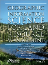
Geographic Information Science for Land Resource Management is a comprehensive book focusing on managing land resources using innovative techniques of spatial information sciences and satellite remote sensing. The enormous stress on the land resources over the years due to anthropogenic activities for commercialization and livelihood needs has increased manifold. The only solution to this problem lies in stakeholder awareness, which can only be attained through scientific means. The awareness is the basis of the sustainable development concept, which involves optimal management of natural resources, subject to the availability of reliable, accurate, and timely information from the global to local scales.
GIScience consists of satellite remote sensing (RS), Geographical Information System (GIS), and Global Positioning System (GPS) technology that is nowadays a backbone of environmental protection, natural resource management, and sustainable development and planning. Being a powerful and proficient tool for mapping, monitoring, modeling, and managing natural resources can help understand the earth surface and its dynamics at different observational scales. Through the spatial understanding of land resources, policymakers can make prudent decisions to restore and conserve critically endangered resources, such as water bodies, lakes, rivers, air, forests, wildlife, biodiversity, etc.
This innovative new volume contains chapters from eminent researchers and experts. The primary focus of this book is to replenish the gap in the available literature on the subject by bringing the concepts, theories, and experiences of the specialists and professionals in this field jointly. The editors have worked hard to get the best literature in this field in a book form to help the students, researchers, and policymakers develop a complete understanding of the land system vulnerabilities and solutions.
عن المؤلف
Suraj Kumar Singh, Ph.D., is an associate professor and coordinator at the Centre for Sustainable Development, Suresh Gyan Vihar University, Jaipur, India. He has published various research papers in national and international journals and participated in and organized international conferences, workshops, symposiums, and webinars. He is presently on the reviewer panel for several research journals and supervises several Ph.D. students on their dissertations.
Shruti Kanga, Ph.D., is an associate professor and coordinator at the Centre for Climate change and Water Research, Suresh Gyan Vihar University, Jaipur, India. She has authored more than 60 publications in various peer-reviewed national and international journals with more than 400 citations. She is presently on the reviewer panel for several research journals and supervises several Ph.D. students on their dissertations.
Gowhar Meraj, M Phil, M Sc, is a young scientist fellow in the Department of Science and Technology in India’s Department of Ecology. He has also worked as a consultant with World Bank Group, New Delhi, for its South Asia Water Initiative Program. He has more than nine years of research and teaching experience and is on the reviewer panel for several research journals.
Majid Farooq, M Tech, M Sc, is a scientist-D at the Department of Ecology, Environment and Remote Sensing, Government of Jammu and Kashmir, India. He has more than 15 years of experience in research, teaching, and consultancy related to remote sensing and GIS, such as climate change vulnerability assessments, flood modeling, ecosystem assessment, and watershed management.
Sudhanshu, Ph.D., is a veteran researcher in the field of applied geology and geosciences. He has more than 30 years of research and academic experience and is currently the chief mentor of Suresh Gyan Vihar University, Jaipur. He is on the reviewer panel for several research journals and supervises several Ph.D. students on their dissertations.


