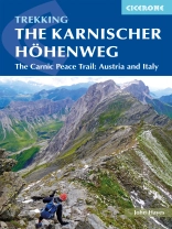
This guidebook describes the Karnischer Höhenweg, a 170km long-distance walk through the beautiful Carnic Alps which straddle the border between Austria and Italy. Following a high Alpine trail along the main ridge, the route is clearly waymarked and requires a reasonable level of fitness, a sense of adventure and a head for heights, but no special equipment or technical expertise. It can be walked between mid-July and the end of September and takes up to a fortnight, though it is possible to devise shorter itineraries taking in the highlights.
The guide describes the full route of the Karnischer Höhenweg from Arnbach, near Sillian, to Arnoldstein, near Villach, and includes plenty of practical information to help you prepare for the walk. Each stage features comprehensive route description, clear mapping and fascinating insights into the history of the ‚war in the mountains‘ plus other local points of interest. Accommodation listings and other useful contacts can be found in the appendices.
Also known as the Friedensweg (‚Peace Trail‘), the route follows the First World War front line, and reminders of the conflict are everywhere. But the trail isn’t just rich in historical interest: this is Alpine ridge-walking at its best, boasting spectacular mountain vistas and views of the Dolomites, Hohe Tauern and Julian Alps. The guide covers two key variants of the trail, one on the Austrian side of the border, the other on the Italian side. Also included is an optional ascent of Monte Coglians, the highest peak in the Carnic Alps, and a visit to the open-air museum at the Plöckenpass.
Inhaltsverzeichnis
Map key
Area map
Route overview map
Route summary tables
Introduction
The Peace Trail
The route
World War I earthworks and remains
The landscape and views
Geology
Plants and wildlife
How hard is the walk?
Selecting an itinerary
Getting to and from the route
When to go
Accommodation and food
Budget
What to take
Routefinding
Safety and emergencies
Using this guide
The route
Stage 1 Arnbach to Obstanserseehtte
Stage 2 Obstanserseehtte to Porzehtte
Stage 3 Porzehtte to Hochweisteinhaus
Stage 4 Austrian route: Hochweisteinhaus to Gasthof Valentinalm
Stage 4A Italian route: Hochweisteinhaus to Rifugio Marinelli
Stage 5 Austrian route: Gasthof Valentinalm to Zollnerseehtte
Stage 5A Italian route: Rifugio Marinelli to Plckenpass
Stage 5B Italian route: Plckenpass to Casera Pramosio
Stage 5C Italian route: Casera Pramosio to Zollnerseehtte
Stage 6 Zollnerseehtte to Nassfeld
Stage 7 Nassfeld to Gasthaus Starhand
Stage 8 Gasthaus Starhand to Arnoldstein
Appendix A Route breakdown
Appendix B Accommodation
Appendix C Useful contacts
Über den Autor
John Hayes is a retired management consultant with degrees from Liverpool University and University College London. Immediately after finishing work in 2011 he embarked on an epic 5, 000km trek across Europe, walking from Tarifa in Spain to Budapest. The veteran of numerous long treks in the Alps, Spain and the Himalayas, John has written for numerous walking and trekking magazines.


