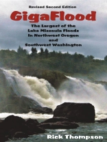
Covering a brief history of Glacial Lake Missoula and the factors leading to its creation and dam-bursting flood, Giga Flood follows the path of the largest of the Lake Missoula Floods, as its 540 cubic miles of water, 40 cubic miles of ice, 50 cubic miles of rock, sediment and debris tore down the Columbia River Gorge at speeds up to 65 miles per hour, and traces the influx and exit channels in the areas north and south of the Columbia River as it overflowed the Portland/Vancouver area as well as the Clackamas, Tualatin Yamhill and Willamette valleys up to the 400 foot level.
With 208 pages, 182 photographs, 52 maps, and 10 illustrations, Giga Flood reveals the many indelible marks left on the landscape such as kolk lakes, gravel bars 200-300 feet high, truncated hillsides, flood channels, and erratics boulders. Many of these subtle features were previously unrecognized though hidden in plain sight.
Like a detective story Giga Flood points out the clues in NW Oregon and SW Washington that show the effects of this cataclysm and reveals what those features are and how they were formed. You will see this area with new eyes and it will never be the same again.
Inhaltsverzeichnis
Foreword
Preface
Acknowledgements
Introduction:The Giga Flood Story
Chapter 1:The Ice Age
Chapter 2:Ice Sheets and Ice Lobes
Chapter 3:The Lake Missoula Floods
Chapter 4:Discovering the Floods
Chapter 5:The Channeled Scablands
Chapter 6:Water Gaps
Chapter 7:The Columbia River Gorge
Chapter 8:Clark County Washington
Chapter 9:Gravel Pits and Rock Quarries
Chapter 10:Portland Area Inundation
Chapter 11:Portland Area Flood Channels
Chapter 12:Erratic Boulders
Chapter 13:Tualatin, Yamhill & Willamette Valleys
Chapter 14:The Mad Rush for the Exits
Chapter 15:The Water Departing Through Portland
Glossary
Selected Bibliography
Index
Über den Autor
A native Oregonian, Mr. Thompson is President of the Lower Columbia Chapter of the Ice Age Floods Institute who loves to share the beauty of the great Northwest. Though geology is not his profession, it is his passion. Being intrigued by the land formations, huge boulders and glacial erratics, Mr. Thompson embarked on a twenty-year study to show that unlike the massive expanses of flood features in Eastern Washington this area has its own treasure chest of scablands, flood channels, erratic boulders and dramatic story to tell.
Besides giving talks and leading field trips on the subject Mr. Thompson has developed a number of driving tours and has just completed the revision of his book: Giga Flood – The Largest of the Lake Missoula Floods in Northwest Oregon and Southwest Washington.
