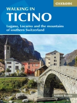
A guidebook describing 38 walks in Ticino, Switzerland. Exploring the lakes and mountains of this beautiful Italianate region, routes are graded by difficulty, from gentle strolls suitable for family outings to strenuous mountain routes sometimes involving scrambling.
The walks range from 4 to 19km (2–12 miles) and can be enjoyed in 1–8 hours. They are presented in four sections, covering Lugano, Locarno, Bellinzona/Biasca and Airolo.
- Clear route description illustrated with 1:50, 000 maps
- GPX files available to download
- Information on refreshments given for each walk
- Local points of interest including St Gotthard Pass
- Easy access from Milan
Tabla de materias
Overview map
Map key
Introduction
History
Ticino today
Geology and landscape
Plants and flowers
Wildlife
Getting there
Local transport and driving
Information and maps
Weather and when to visit
Accommodation
Food and drink
What to take
Walking practicalities
Safety in the mountains
Using this guide
General information
Walks from Lugano
Walk 1 Lake Lugano shoreline from Paradiso to Gandria
Walk 2 Campione d’Italia to Cantine di Gandria
Walk 3 San Salvatore to Morcote
Walk 4 Monte Caslano
Walk 5 Monte San Giorgio
Walk 6 Monte Tamaro to Monte Lema
Walk 7 Monte Boglia and the Denti della Vecchia
Walk 8 Monte Bar and the Capriasca Valley
Walk 9 Cima di Medeglia and the old Military Road
Walks from Locarno
Walk 10 Along the shore of Lake Maggiore
Walk 11 Sentiero Collina Alta and Sentiero Collina Bassa
Walk 12 Cimetta to Mergoscia via Capanna dei Monti di Lego
Walk 13 The Centovalli from Camedo to Intragna
Walk 14 The Valle del Salto
Walk 15 Along the Val Lavizzara from Fusio to Bignasco
Walk 16 Capanna Cristallina from Robiei
Walk 17 Bosco Gurin to Cimalmotto
Walk 18 Sentiero per l’Arte
Walk 19 Revöira and Ca d D&##xe9;nt
Walk 20 Lavertezzo to the Verzasca Dam
Walks from Bellinzona and Biasca
Walk 21 Monte Carasso, Sementina and the Ponte Tibetano
Walk 22 Capanna Ganzianella and Motto della Croce
Walk 23 The ‘Iron Route’ from Carena
Walk 24 Mornera and the Capanna Albagno
Walk 25 Camorino and the Hunger Towers
Walk 26 Capanna Brogoldone and the Santa Maria Monastery
Walk 27 Val Blenio Sentiero Storico
Walk 28 Val Blenio Strada Alta
Walk 29 Lukmanier Pass to Olivone via Passo di Gana Negra
Walks from Airolo
Walk 30 Sentiero Alta Val Bedretto
Walk 31 Circuit of lakes at the summit of the St Gotthard Pass
Walk 32 Sentiero Bassa Val Bedretto
Walk 33 Along the Val Torta to Capanna Cristallina
Walk 34 Nufenenpass and the Upper Val Bedretto
Walk 35 Strada Alta Valle Leventina (north side)
Walk 36 Sentiero Alta Valle Leventina (south side)
Walk 37 Circuit of Lago Ritom
Walk 38 Lago Tremorgio and Capanna Leit
Appendix A Route summary table
Appendix B Useful contacts
Appendix C Glossary of Italian words
Sobre el autor
Andrew Beattie has been writing and travelling ever since he left Oxford University with a degree in Geography. He has a long-standing interest in the Alps and in 2000 he co-wrote a book on Ticino which to this day remains the only general guidebook in English published on the region. He is also the author of a cultural-historical guide to the Alps published by Signal Books. Away from the Alps, his writing has taken him to many other parts of Europe, as well as the Middle East – he has worked on books in the Rough Guides series on Switzerland, Germany and Syria, while other books for Signal include cultural-historical guides to Prague, Cairo, the River Danube and the Scottish Highlands. His website www.andrewbeattie.me.uk includes galleries of photos taken for these books and for Cicerone’s Walking in Ticino.


