Professor Lei YAN is the director of Beijing Key Lab of Spatial Information integration and 3s application (Peking University).
Lei YAN works on Remote Sensing, Geographic Information System and navigation field, and undertakes many related national major projects.
In 2012, Lei YAN won the first prize of Beijing Science and Technology Progress Award (natural science).
In 2013, Polarization Remote Sensing Image System invented by Lei YAN won gold medal of the 41th International Exhibition of Inventions of Geneva.
In 2013, Lei YAN won the third prize of Beijing Science and Technology Progress Award (natural science).
In 2015, Lei YAN won the second prize of National Technology Invention Award.
In 2016, Lei YAN won the honorable mention of the 18th China Patent Award.
In 2017, Polarization Remote Sensing Image System invented by Lei YAN won Gold Medal with the congratulations of the jury of the 45th International Exhibition of Inventionsof Geneva.
3 Ebooks de Lei Yan
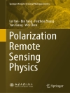
Lei Yan & Bin Yang: Polarization Remote Sensing Physics
This book elaborates on the physical principles of polarization remote sensing. It explains the reflective characteristics of surface objects and atmosphere separately, including theory, experiment, …
PDF
Inglés
€181.89
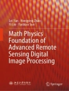
Yi Lin & Yanbiao Sun: Math Physics Foundation of Advanced Remote Sensing Digital Image Processing
This book focuses on the mathematical and physical foundations of remote sensing digital image processing and introduces key algorithms utilized in this area. The book fully introduces the basic math …
EPUB
Inglés
DRM
€127.75
Lei Yan & An Li: Mathematical and Physical Fundamentals of Navigation and Positioning with Earth’s Natural Fields
This book covers various fields relevant to navigation, including Earth’s magnetic field, gravity field, topography, celestial polarization field, electrostatic field, and relativistic celestial fiel …
PDF
Inglés
€171.19


