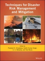
A comprehensive guide to managing and mitigating natural disasters
Recent years have seen a surge in the number, frequency, and severity of natural disasters, with further increases expected as the climate continues to change. However, advanced computational and geospatial technologies have enabled the development of sophisticated early warning systems and techniques to predict, manage, and mitigate disasters.Techniques for Disaster Risk Management and Mitigation explores different approaches to forecasting disasters and provides guidance on mitigation and adaptation strategies.
Volume highlights include:
* Review of current and emerging technologies for disaster prediction
* Different approaches to risk management and mitigation
* Strategies for implementing disaster plans and infrastructure improvements
* Guidance on integrating artificial intelligence with GIS and earth observation data
* Examination of the regional and global impacts of disasters under climate variability
Tabla de materias
Contributors ix
Preface xiii
Section I: Introduction
1. Concepts and Methodologies of Environmental Hazards and Disasters 3
Nicolas R. Dalezios, George P. Petropoulos, and Ioannis N. Faraslis
2. Indigenous Knowledge for Disaster Solutions in the Hilly State of Mizoram, Northeast India 23
Kewat Sanjay Kumar, Awadhesh Kumar, Vinod Prasad Khanduri, and Sudhir Kumar Singh
3. Urban Risk and Resilience to Climate Change and Natural Hazards: A Perspective from Million-Plus Cities on the Indian Subcontinent 33
Amit Kumar, Diksha, A. C. Pandey, and M. L. Khan
4. The Contribution of Earth Observation in Disaster Prediction, Management, and Mitigation: A Holistic View 47
Varsha Pandey, Prashant K. Srivastava, and George P. Petropoulos
Section II: Atmospheric Hazards and Disasters
5. Tropical Cyclones Over the North Indian Ocean in Changing Climate 65
R. Bhatla, Raveena Raj, R. K. Mall, and Shivani
6. Simulation of Intensity and Track of Tropical Cyclones Over the Arabian Sea Using the Weather Research and Forecast (WRF) Modeling System with Different Initial Conditions (ICs) 77
Sushil Kumar, Ashish Routray, Prabhjot Singh Chawla, and Shilpi Kalra
7. Development of a Soft Computing Model from the Reanalyzed Atmospheric Data to Detect Severe Weather Conditions 85
Devajyoti Dutta, Ashish Routray, and Prashant K. Srivastava
8. Lightning, the Global Electric Circuit, and Climate 93
N. Jeni Victor, Sagarika Chandra, and Devendraa Siingh
9. An Exploration of the Panther Mountain Crater Impact Using Spatial Data and GIS Spatial Correlation Analysis Techniques 111
Sawyer Reid Stippa, Konstantinos P. Ferentinos, and George P. Petropoulos
Section III: Land Hazards and Disasters
10. Satellite Radar Interferometry Processing and Elevation Change Analysis for Geoenvironmental Hazard Assessment 127
Sergey Stankevich, Iryna Piestova, Anna Kozlova, Olga Titarenko, and Sudhir Kumar Singh
11. Assessing the Use of Sentinel-2 in Burnt Area Cartography: Findings from a Case Study in Spain 141
Craig Amos, Konstantinos P. Ferentinos, George P. Petropoulos, and Prashant K. Srivastava
12. Assimilating SEVIRI Satellite Observation into the Name-III Dispersion Model to Improve Volcanic Ash Forecast 151
Prajakta Patil, I. M. Watson, Shona Mackie, Prashant K. Srivastava, Tanvir Islam, and Sourabh Sakhare
13. Geoinformation Technology for Drought Assessment 171
Arnab Kundu, D. M. Denis, N. R. Patel, R. K. Mall, and Dipanwita Dutta
14. Introduction to Landslides 181
H. K. Pandey
15. Probabilistic Landslide Hazard Assessment using Statistical Information Value (SIV) and GIS Techniques: A Case Study of Himachal Pradesh, India 197
Ankit Sharma, Ujjwal Sur, Prafull Singh, Praveen Kumar Rai, and Prashant K. Srivastava
16. One-Dimensional Hydrodynamic Modeling of the River Tapi: The 2006 Flood, Surat, India 209
Dhruvesh P. Patel, Prashant K. Srivastava, Sudhir Kumar Singh, Cristina Prieto, and Dawei Han
Section IV: Ocean Hazards and Disasters
17. Tropical Cyclone-Induced Storm Surges and Wind Waves in the Bay of Bengal 239
Prasad K. Bhaskaran, A. D. Rao, and Tad Murty
18. Space-Based Measurement of Rainfall Over India and Nearby Oceans Using Remote Sensing Application 295
Anoop Kumar Mishra and Kishan Singh Rawat
19. Modeling Tsunami Attenuation and Impacts on Coastal Communities 309
S. Piché, I. Nistor, and T. Murty
Index 325
Sobre el autor
Edited by
Prashant K. Srivastava, Assistant Professor, Institute of Environment and Sustainable Development, Banaras Hindu University, Varanasi, India.
Sudhir Kumar Singh, Assistant Professor, K. Banerjee Centre of Atmospheric & Ocean Studies, IIDS, Nehru Science Centre, University of Allahabad, Prayagraj, India.
U. C. Mohanty, Visiting Professor, School of Earth Ocean and Climate Sciences, Indian Institute of Technology Bhubaneswar, Argul, India.
Tad Murty, Formerly Adjunct Professor, Department of Civil Engineering and Earth Sciences, University of Ottawa, Ottawa, ON, Canada.
