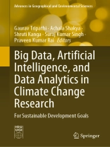
This book explores the potential of big data, artificial intelligence (AI), and data analytics to address climate change and achieve the Sustainable Development Goals (SDGs). Furthermore, the book covers a wide range of related topics, including climate change data sources, big data analytics techniques, remote sensing, renewable energy, open data, public–private partnerships, ethical and legal issues, and case studies of successful applications. The book also discusses the challenges and opportunities presented by these technologies and provides insights into future research directions.
In order to address climate change and achieve the SDGs, it is crucial to understand the complex interplay between climate and environmental factors. The use of big data, AI, and data analytics can play a vital role in this effort by providing the means to collect, process, and analyze vast amounts of environmental data. This book is an essential resource for researchers, policymakers, and practitioners interested in leveraging these technologies to tackle the pressing challenge of climate change and achieve the SDGs.
Table of Content
Experimental analysis of Precipitation Forecasting Using Machine Learning and Distributed Machine Learning Approach.- Analysis of Inherent Memory in Hydroclimatic Time Series: Implications for Statistical Tests and Long-Term Data Generation.- Intelligent Solutions for Flood Management: Integrating Artificial Intelligence and Machine Learning.- Artificial Intelligence and Machine Learning based building solutions: Pathways to ensure occupants comfort and energy efficiency with climate change.- Deep Learning models for fine-scale Climate Change prediction: enhancing spatial and temporal resolution using AI.- Exploring streamflow variation in the Subarnarekha River basin, Jharkhand, India.- Geoinformatics Based Land Degradation Susceptibility Analysis and Sustainability of Palghar Sea Coastal Areas.- Climate Change and Maritime Security in the Indo-Pacific Region: A Strategic Approach.- Climate Change and Renewable Energy.- Sustainable Development Goals and Indian Himalayan Region.- Climate Change and Energy Aspects.- Mustard Yield forecast using Radiation use efficiency method.- Public Private Partnership for Climate Change Research.- Groundwater and Sustainable Development Goals: Water Table Characteristics in Varanasi City.- Approach of Hydro geomorphological Mapping for Groundwater Resource Management in Mirzapur District, Uttar Pradesh.- Soil erosion assessment of Rohru C.D. Block of Himachal Pradesh using Geospatial Tools.- Impact of Sarangkheda Dam construction on the downstream reach of Tapi River, Nandurbar District, Maharashtra.
About the author
Mr. Gaurav Tripathi is an assistant professor at the Centre for Climate Change and Water Research, Suresh Gyan Vihar University, Jaipur, India. His many research interests include atmospheric remote sensing, satellite remote sensing, satellite navigation, disaster management, synthetic aperture radar (SAR), In SAR, DIn SAR, SAR polarimetry, interferometry, tomography, information theory, and retrieval modeling. He completed his post-graduate diploma in geo-information science and earth observation with specialization in geo-informatics from the International Institute for Geo-Information Science and Earth Observation (ITC) Netherlands and the Indian Institute of Remote Sensing, Indian Space Research Organization (ISRO), Dehradun. He has published 10 journal articles and 6 book chapters.
Dr. Achala Shakya is an assistant professor at the School of Computer Sciences, UPES, Dehradun, Uttarakhand, India. Previously, she was associated with the Department of Computer Science and Engineering at Sharda University, Greater Noida, India. She was awarded her Ph.D. from the Department of Computer Engineering at the National Institute of Technology Kurukshetra and was also involved in the NASA-ISRO Synthetic Aperture Radar Mission (NISAR) project. She has more than 4 years of research and 1 year of teaching experience, having published some 10 research articles, 5 book chapters, and 2 international conference papers. She works in the fields of image fusion and segmentation, optical radar, hyperspectral remote sensing, deep learning, machine learning, natural language processing, information retrieval, and web development.
Dr. Shruti Kanga is an associate professor and the head of the Department of Geography at the Central University of Punjab, Bathinda, India. Previously, she worked as an associate professor and a coordinator at the Centre for Climate Change and Water Research, Suresh Gyan Vihar University, Jaipur, and as an assistant professor at the Central University of Jharkhand, Brambe, Ranchi. She earned her Ph.D. in technology (geo-informatics) from the Department of Remote Sensing at the Birla Institute of Technology in Ranchi. She has published 108 journal articles, 12 edited and authored books, and 30 book chapters. Her numerous research interests include geographic information science in forest fire modeling, natural hazards, natural resource management, geographic information systems, land use management, risk assessment, fire ecology, satellite image analysis, satellite image processing, land use modeling, land degradation, and desertification.
Dr. Suraj Kumar Singh is currently an associate professor and coordinator at the Centre for Sustainable Development, Suresh Gyan Vihar University, Jaipur, India. Previously, he worked as an assistant professor at the Central University of Jharkhand, Brambe, Ranchi. Prior to that, he also served as a research associate at the National Remote Sensing Centre, Indian Space Research Organization. He earned his Ph.D. degree in 2012 from the Department of Remote Sensing, the Birla Institute of Technology, Ranchi. His research interests include waterlogging and flood hazards, geospatial applications in water resources, disaster management, hydro-geomorphology, urban planning, and wasteland mapping. He has published nearly 125 articles in peer-reviewed journals, 16 books, and 30 book chapters. He has also organized and attended various workshops, seminars, and international conferences.
Dr. Praveen Kumar Rai is an associate professor in the Department of Geography, Khwaja Moinuddin Chishti Language University, Lucknow, Uttar Pradesh, India. He has more than 13 years of teaching and research experience in the field of remote sensing and geographic information systems. He completed his M.Sc. in geography, specializing in remote sensing, in Banaras Hindu University, India, in 2006 and an M.Tech. and Ph.D. in remote sensing in the Birla Institute of Technology, Mesra, India, in 2008 and 2013, respectively. His research interests include remote sensing and GIS, glaciology, health and disease modelling, disaster management, and water resource management, among other areas. He has published more than 65 research papers in international and national journals of repute and also has published 4 books in various applications of remote sensing and GIS. He has visited many countries to present invited lectures as keynote speaker. He has also served as an editorial board member and as a reviewer for many international journals.


