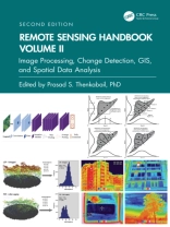
Volume II of the Six Volume Remote Sensing Handbook, Second Edition, is focused on digital image processing including image classification methods in land cover and land use. It discusses object-based segmentation and pixel-based image processing algorithms, change detection techniques, and image classification for a wide array of applications including land use/land cover, croplands, urban studies, processing hyperspectral remote sensing data, thermal imagery, light detection and ranging (Li DAR), geoprocessing workflows, frontiers of GIScience, and future pathways. This thoroughly revised and updated volume draws on the expertise of a diverse array of leading international authorities in remote sensing and provides an essential resource for researchers at all levels interested in using remote sensing. It integrates discussions of remote sensing principles, data, methods, development, applications, and scientific and social context.Features Provides the most up-to-date comprehensive coverage of digital image processing. Highlights object-based image analysis (OBIA) and pixel-based classification methods and techniques of digital image processing. Demonstrates practical examples of image processing for a myriad of applications such as land use/land cover, croplands, and urban. Establishes image processing using different types of remote sensing data that includes multispectral, radar, Li DAR, thermal, and hyperspectral. Highlights change detection, geoprocessing, and GIScience. This volume is an excellent resource for the entire remote sensing and GIS community. Academics, researchers, undergraduate and graduate students, as well as practitioners, decision makers, and policymakers, will benefit from the expertise of the professionals featured in this book, and their extensive knowledge of new and emerging trends.
Prasad S. Thenkabail
Remote Sensing Handbook, Volume II [PDF ebook]
Image Processing, Change Detection, GIS, and Spatial Data Analysis
Remote Sensing Handbook, Volume II [PDF ebook]
Image Processing, Change Detection, GIS, and Spatial Data Analysis
यह ईबुक खरीदें और 1 और मुफ़्त पाएं!
भाषा अंग्रेज़ी ● स्वरूप PDF ● पेज 506 ● ISBN 9781040194331 ● संपादक Prasad S. Thenkabail ● प्रकाशक CRC Press ● प्रकाशित 2024 ● डाउनलोड करने योग्य 3 बार ● मुद्रा EUR ● आईडी 10019365 ● कॉपी सुरक्षा Adobe DRM
एक DRM सक्षम ईबुक रीडर की आवश्यकता है


