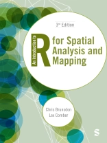
The ever-expanding availability of spatial data continues to revolutionise research. This book is your go-to guide to getting the most out of handling, mapping and analysing location-based data.
Without assuming prior knowledge of GIS, geocomputation or R, this book helps you understand spatial analysis and mapping and develop your programming skills, from learning about scripting and writing functions to point pattern analysis and spatial attribute analysis.
The book:
- Illustrates approaches to analysis on a range of datasets that are new to this edition.
- Enables you to put your skills into practice with embedded exercises and over 30 self-test questions.
- Showcases the possibilities of using spatial analysis to explore spatial inequalities.
Whether you’re an R novice or experienced user, this book equips upper undergraduates, postgraduates and researchers with the tools needed for spatial data handling and rich analysis.
Daftar Isi
Chapter 1: Introduction and Getting Started
Chapter 2: Data and Plots
Chapter 3: Spatial Data Handling in R
Chapter 4: Scripting and Writing Functions in R
Chapter 5: Using R as a GIS
Chapter 6: Point Pattern Analysis Using R
Chapter 7: Spatial Attribute Analysis With R: Point Based Data
Chapter 8: Spatial Attribute Analysis With R: Area Based Data
Chapter 9: Localised Spatial Analysis
Chapter 10: Working with Data from the Internet
Epilogue: Spatial Analysis and R – Review and Prospect
Tentang Penulis
Alexis Comber, Lex, is Professor of Spatial Data Analytics at Leeds Institute for Data Analytics (LIDA) the University of Leeds. He worked previously at the University of Leicester where he held a chair in Geographical Information Science. His first degree was in Plant and Crop Science at the University of Nottingham and he completed a Ph D in Computer Science at the Macaulay Institute, Aberdeen (now the James Hutton Institute) and the University of Aberdeen. This developed expert systems for land cover monitoring from satellite imagery and brought him into the world of spatial data, spatial analysis, and mapping. Lex’s research interests span many different application areas including environment, land cover / land use, demographics, public health, agriculture, bio-energy and accessibility, all of which require multi-disciplinary approaches. His research draws from methods in geocomputation, mathematics, statistics and computer science and he has extended techniques in operations research / location-allocation (what to put where), graph theory (cluster detection in networks), heuristic searches (how to move intelligently through highly dimensional big data), remote sensing (novel approaches for classification), handling divergent data semantics (uncertainty handling, ontologies, text mining) and spatial statistics (quantifying spatial and temporal process heterogeneity). He has co-authored (with Chris Brunsdon) An Introduction to R for Spatial Analysis and Mapping, the first ‘how to book’ for spatial analyses and mapping in R, the open source statistical software, now in its second edition.Outside of academic work and in no particular order, Lex enjoys his vegetable garden, walking the dog and playing pinball (he is the proud owner of a 1981 Bally Eight Ball Deluxe).


