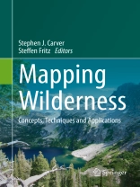
Das E-Book Mapping Wilderness wird angeboten von Springer Netherlands und wurde mit folgenden Begriffen kategorisiert:
Global Inaccessibilty;Spatial Technology;Mapping Human Impact;Wilderness;Conservation;Computational Approaches
Tabella dei contenuti
Contents .- List of Contributors.-Preface.-Acknowledgments.-Dedication.-1. Introduction.-2. The wilderness continuum concept and its application in Australia: Lessons for modern conservation.-3. Connectivity, networks, cores and corridors.-4. The Use of Spatial Technology in USDA Forest Service Wilderness Recreation Site Surveys.-5. Wild Vistas : Progress in Computational Approaches to ‘Viewshed’ Analysis.-6. Mapping Human Impact using Crowdsourcing.-7. Visualising spaces of global inaccessibility.-8. Addressing Weak Legal Protection of Wilderness: Deliberate Choices and Drawing Lines on the Map.-9. Unraveling the Coil of the Wild: Geospatial Technology and Wilderness.-10. Wilderness areas in Romania, a case study on the South Western Carpathians.-11. Purism scale approach for wilderness mapping in Iceland.-12. Is there something wild in Austria?-13. Conclusions.-Author Index.-Subject Index
Circa l’autore
Steve Carver
Steve is a geographer with an interest in application of GIS to wilderness and wild landscapes. He is particularly interested in quality assessment, public participation and visibility analyses. He has worked widely on these topics in the UK, Europe and North America. He is Director of the Wildland Research Institute, and is based in the School of Geography, University of Leeds.
Steffen Fritz
Steffen is Head of the Earth Observation Systems group in the Ecosystems Services and Management Program at IIASA. Steffen is the main driver behind Geo-Wiki and is currently researching different incentive schemes for crowdsourcing of land cover in Kenya, Tanzania and Austria through the European Research Council funded project called Crowd Land. His Ph D was on wilderness mapping under the supervision of Steve Carver.
