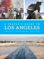
A People’s Guide to Los Angeles offers an assortment of eye-opening alternatives to L.A.’s usual tourist destinations. It documents 115 little-known sites in the City of Angels where struggles related to race, class, gender, and sexuality have occurred. They introduce us to people and events usually ignored by mainstream media and, in the process, create a fresh history of Los Angeles. Roughly dividing the city into six regions—North Los Angeles, the Eastside and San Gabriel Valley, South Los Angeles, Long Beach and the Harbor, the Westside, and the San Fernando Valley—this illuminating guide shows how power operates in the shaping of places, and how it remains embedded in the landscape.
Jadual kandungan
List of Maps
An Introduction to A People’s Guide to Los Angeles
Los Angeles County Map
Chapter One: North Los Angeles
An Introduction to North Los Angeles
Map of North Los Angeles
North Los Angeles Sites
1.1 Biddy Mason Park • 1.2 Black Cat Bar • 1.3 Bus Riders Union and Labor/Community Strategy Center • 1.4 Caballeros de Dimas-Alang and Philippines Review • 1.5 California Club • 1.6 Calle de Los Negros • 1.7 Chavez Ravine • 1.8 Chinatowns • 1.9 Cho Sun Galbee Restaurant • 1.10 Downey Block • 1.11 El Congreso del Pueblo de Habla Española • 1.12 Embassy Hotel and Auditorium • 1.13 Fernando’s Hideaway and Sisters of GABRIELA, Awaken! • 1.14 Gay Liberation Front (1969–1972)/Former Home of Morris Kight • 1.15 Gay Women’s Service Center • 1.16 If Café and Open Door • 1.17 Instituto de Educación Popular del Sur de California (IDEPSCA) and Villa Park • 1.18 Kyoto Grand Hotel • 1.19 L.A. Live • 1.20 La Placita and Cathedral of Our Lady of the Angels • 1.21 League of Southern California Japanese Gardeners • 1.22 Los Angeles Police Department Headquarters and Parker Center • 1.23 Los Angeles River Center and Gardens • 1.24 Los Angeles Times Building (Former) • 1.25 Musicians Union Hall (Local 47) • 1.26 Orpheum Theatre, Sleepy Lagoon Murder, and Ventura School for Girls • 1.27 Partido Liberal Mexicano • 1.28 Pershing Square • 1.29 Roosevelt Hotel—the Cinegrill • 1.30 Tropical America Mural • 1.31 Yang-Na
Chapter Two: The Greater Eastside and San Gabriel Valley
An Introduction to the Greater Eastside and San Gabriel Valley
Map of the Greater Eastside and San Gabriel Valley
Greater Eastside and San Gabriel Valley Sites
2.1 Alma Avenue—Residential Discrimination Site • 2.2 Altadena Open Housing Covenant • 2.3 AMVAC Chemical Corporation • 2.4 Atlantic Square • 2.5 Cathay Bank • 2.6 East Los Angeles Prison (Proposed) and Vernon Incinerator (Proposed) • 2.7 El Espectador • 2.8 El Monte Sweatshop • 2.9 Haramokngna American Indian Cultural Center • 2.10 Hicks Camp/Rio Vista Park • 2.11 Lacy Park • 2.12 Llano del Rio • 2.13 Mariachi Plaza • 2.14 Mount Sinai Home Care Agency • 2.15 Ninth Circuit Court of Appeals (Richard Chambers Courthouse) • 2.16 Owen Brown’s Gravesite • 2.17 Quemetco, Incorporated • 2.18 Ruben Salazar Park and Silver Dollar Café • 2.19 San Gabriel Mission • 2.20 Santa Anita Park and Pomona Fairgrounds • 2.21 Self-Help Graphics and Art • 2.22 Upton Sinclair’s House • 2.23 Whittier State School
Chapter Three: South Los Angeles
An Introduction to South Los Angeles
Map of South Los Angeles
South Los Angeles Sites
3.1 Alameda Boulevard • 3.2 Alondra Park • 3.3 American Indian Movement, Los Angeles Chapter • 3.4 Bicycle Club Casino • 3.5 Black Panther Party Headquarters • 3.6 California Eagle • 3.7 Chuco’s Justice Center and FREE L.A. High School • 3.8 Compton Communicative Arts Academy • 3.9 Dorothy Ray Healey’s House • 3.10 Duke Brothers’ Automotive Shop • 3.11 Dunbar Hotel • 3.12 Eso Won Bookstore and Leimert Park • 3.13 Firestone Tire and Rubber • 3.14 Holiday Bowl • 3.15 Holman United Methodist Church • 3.16 Indian Revival Center • 3.17 Kashu Realty and Thirty-sixth Street Residential Discrimination Site • 3.18 Los Angeles Memorial Coliseum • 3.19 Maywood City Hall • 3.20 Mercado La Paloma • 3.21 Peace and Freedom Party, Los Angeles Chapter • 3.22 Southern California Library for Social Studies and Research • 3.23 Trianon Ballroom • 3.24 USC Mc Donald’s Olympic Swim Stadium
Chapter Four: The Harbor and South Bay
An Introduction to the Harbor and South Bay
Map of the Harbor and South Bay
Harbor and South Bay Sites
4.1 Baypoint Avenue Residential Discrimination Site • 4.2 Bixby Park • 4.3 Lakewood City Hall • 4.4 Mark Twain Library and Cambodia Town • 4.5 Miramar Park • 4.6 Port of Los Angeles and Liberty Hill • 4.7 Puvungna • 4.8 Terminal Island • 4.9 White Point Preserve and Education Center • 4.10 Ziba Beauty Center
Chapter Five: The Westside
An Introduction to the Westside
Map of the Westside
Westside Sites
5.1 Ballona Wetlands • 5.2 Campbell Hall, UCLA • 5.3 Century City • 5.4 Federal Buildings • 5.5 Highways Performance Space • 5.6 The Ink Well • 5.7 Los Angeles International Airport • 5.8 Malibu Public Beaches • 5.9 Midnight Special and Sisterhood Bookstores • 5.10 West Hollywood City Hall • 5.11 Workmen’s Circle/Arbeter Ring
Chapter Six: The San Fernando Valley and North Los Angeles County
An Introduction to the San Fernando Valley and North Los Angeles County
Map of the San Fernando Valley and North Los Angeles County
San Fernando Valley and North Los Angeles County Sites
6.1 BUSTOP • 6.2 Chicana and Chicano Studies and Pan African Studies Departments, California State University, Northridge • 6.3 Everywoman’s Village • 6.4 General Motors Van Nuys • 6.5 The Great Wall and Social and Public Art Resource Center (SPARC) • 6.6 KPFK Radio Station and Pacifica Archives • 6.7 Lang Station • 6.8 Saint Francis Dam • 6.9 Santa Susana Field Laboratory • 6.10 Simi Valley Courthouse and Site of Rodney King Beating • 6.11 Siutcanga/Village of Los Encinos • 6.12 Tarzana • 6.13 Theodore Payne Foundation for Wildflowers and Native Plants • 6.14 Val Verde Park • 6.15 Wat Thai of Los Angeles
Chapter Seven: Thematic Tours
First Peoples Tour • Radical People-of-Color Movements of the 1960s and ’70s Tour • Queer Politics and Culture Tour • Independent and Alternative Media Tour • Economic Restructuring and Globalization Tour • New Organizing Tour • Environmental Justice Tour
Recommended Reading
Acknowledgments
Credits
Index
Mengenai Pengarang
Laura Pulido is the Collins Chair and Professor in Indigenous, Race, and Ethnic Studies and Geography at the University of Oregon. Among her books is Black, Brown, Yellow, and Left: Radical Activism in Los Angeles. Laura Barraclough is Professor of American Studies at Yale University and the author of Making the San Fernando Valley: Rural Landscapes, Urban Development, and White Privilege. Wendy Cheng is Associate Professor and Chair of American Studies at Scripps College.
