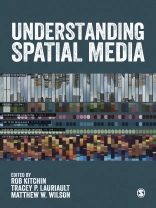
Over the past decade, a new set of interactive, open, participatory and networked spatial media have become widespread. These include mapping platforms, virtual globes, user-generated spatial databases, geodesign and architectural and planning tools, urban dashboards and citizen reporting geo-systems, augmented reality media, and locative media. Collectively these produce and mediate spatial big data and are re-shaping spatial knowledge, spatial behaviour, and spatial politics.
Understanding Spatial Media brings together leading scholars from around the globe to examine these new spatial media, their attendant technologies, spatial data, and their social, economic and political effects.
The 22 chapters are divided into the following sections:
- Spatial media technologies
- Spatial data and spatial media
- The consequences of spatial media
Understanding Spatial Media is the perfect introduction to this fast emerging phenomena for students and practitioners of geography, urban studies, data science, and media and communications.
Tabela de Conteúdo
Understanding spatial media – Rob Kitchin, Tracey P. Lauriault and Matthew W. Wilson
Part 1: Spatial media technologies
GIS – Britta Ricker
Digital Mapping – Jeremy Crampton
Digitally augmented geographies – Mark Graham
Locative and sousveillant media – Jim Thatcher
Social Media – Jessa Lingel
Urban dashboards – Shannon Mattern
Geodesign – Stephen Ervin
Part 2: Spatial data and spatial media
Open spatial data – Tracey P. Lauriault
Geospatial big data – Dan Sui
Indicators, benchmarks and urban informatics – Rob Kitchin, Gavin Mc Ardle & Tracey P. Lauriault
Volunteered Geographic Information and Citizen Science – Muki Haklay
Geo-Semantic Web – Peter Pulsifer and Glenn Brauen
Spatial data analytics – Harvey Miller
Legal rights and spatial media – Teresa Scassa
Part 3: The consequences of spatial media
Spatial knowledge and behaviour – Leighton Evans and Sung-Yueh Perng
Leveraging finance and producing capital – Rob Kitchin
Openness, transparency, participation – Tracey P. Lauriault and Mary Francoli
Producing smart cities – Mike Batty
Surveillance and control – Francisco Klauser and Sarah Widmer
Spatial profiling, sorting and prediction – David Murakami Wood
Geoprivacy – Agnieszka Leszczynski
Sobre o autor
Matthew W. Wilson is an assistant professor in the Department of Geography at the University of Kentucky and a visiting scholar at the Center for Geographic Analysis at Harvard University. He co-founded and co-directs the New Mappings Collaboratory which studies and facilitates new engagements with geographic representation. His research in critical GIS draws upon STS and urban political geography to understand the development and proliferation of location-based technologies, with particular attention to the consumer electronic sector. He has previously taught at the Harvard Graduate School of Design, and his current research project focuses on the founding of the Laboratory for Computer Graphics at Harvard in 1965, a catalyzing moment in the advent of the digital map. His work has been published in leading journals and collections including, Society & Space, Landscape & Urban Planning, Geoforum, The Professional Geographer, Annals of the Association of American Geographers, Cartographica, Social & Cultural Geography, Gender, Place & Culture, and Environment & Planning A.


