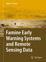
This book describes the interdisciplinary work of USAID’s Famine Early Warning System Network (FEWS NET) and its in uence on how food security crises are identi ed, documented and the kind of responses that result. The book describes FEWS NET’s systems and methods for using satellite remote sensing to identify and describe how biophysical hazards impact the lives and livelihoods of the po- lation where they occur. It presents several illustrative case studies that will dem- strate the integration of both physical and social science disciplines in its work. FEWS NET’s operational needs have driven science in biophysical remote sensing applications through its collaboration with the US Geological Survey, the National Aeronautics and Space Administration, National Oceanographic and Atmospheric Administration, and US Department of Agriculture, as well as methodologies in the social science domain through its support of the US Agency for International – velopment, UN World Food Program and numerous international non-governmental organizations such as Save the Children, Oxfam and others. Because FEWS NET is an organization that must provide a global picture of food insecurity to decision makers, the information it relies on are by necessity – servable and able to be documented. Thus many aspects of traditional livelihood analysis, for example, cannot be used by FEWS NET as they rely upon relati- ships, and ways of expressing power and knowledge at the local scale that cannot be easily scaled up to express variations in access to food at a community level.
Innehållsförteckning
Background.- Conceptual Frameworks.- FEWS NET’s Structure and Remote Sensing.- Remote Sensing for Early Warning.- Rainfall Estimates.- Derived Agricultural and Climate Monitoring Products.- Vegetation Index Measurements.- Climate Forecasts.- Food Security Analysis.- FEWS NET’s Integrated Analytical Areas.- Dynamic Communication and Decision Support.- Use of Remote Sensing in FEWS NET Country and Regional Offices.- Population Datasets.- Food Markets and Prices.- Scenario Development and Contingency Planning.- Case Studies.- Case Study: Ethiopia and the 2002–2003 Food Security Crisis.- Remote Sensing Data in the Mesoamerican Food Security Early Warning System (MFEWS).- Zimbabwe’s Crisis of 2006–2007.- Analysis and the Future.- Power, Politics and Remote Sensing.- The Future of FEWS NET.
Om författaren
Molly E. Brown received a master’s of arts degree in 1998 and a doctor of philosophy in the summer of 2002 from the Department of Geography, University of Maryland at College Park. She has worked with the GIMMS group at NASA’s Goddard Space Flight Center since 1997, primarily on developing and using a stable, 25-year, 8km vegetation record from the NOAA-AVHRR series of instruments. Using these satellite data to investigate questions of climate, land use, and human-environmental interaction has been the main focus of her work.
