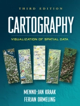
Integrating cutting-edge technology with traditional cartographic principles, this text provides a framework for effectively visualizing and analyzing geospatial data. It gives students critical concepts and methods for harnessing the enormous amount of geospatial data that is available on the Internet and creating maps that can support real-world decision making. The writing style is straightforward and accessible. Illustrated throughout with highly instructive diagrams and sample maps, the book includes 58 color plates.
สารบัญ
1. Geographical Information Science and Maps2. Data Acquisition3. Map Characteristics4. GIS Applications: Which Map to Use?5. Map Design and Production6. Topography7. Statistical Mapping8. Mapping Time9. Maps at Work: Presenting and Using Geospatial Data in Maps and Atlases10. Maps at Work: Analysis and Geovisualization11. Cartography at Work: Maps as Decision Tools
เกี่ยวกับผู้แต่ง
Menno-Jan Kraak is Professor of Geovisualization at the Faculty of Geoinformation Science and Earth Observation, University of Twente, The Netherlands. Ferjan Ormeling is Professor of Cartography at the Faculty of Geosciences at Utrecht University, The Netherlands.


