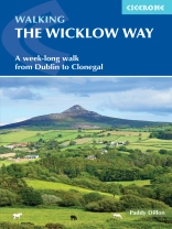
A guidebook to walking the Wicklow Way between Dublin and Clonegal. Covering 130km (81 miles), Ireland’s first long-distance trail takes around 1 week to hike and is suitable for any reasonably fit walker.
The route is described from north to south in 7 stages, each between 9 and 23km (6–14 miles) in length. A variety of optional variants following adjacent trails are also included.
- 1:50, 000 maps included for each stage
- GPX files available to download
- Detailed information about accommodation, refreshments and public transport along the route
- Advice on planning and preparation
- Highlights include Glendalough and the ruins of the Monastic City
สารบัญ
Map key
Overview map
Route summary table
Introduction
Geology
Scenery
History
Wildlife
Plantlife
Wicklow Mountains National Park
Travel to and from the Wicklow Way
When to walk
Accommodation
Food and drink
Money matters
Communications
Daily schedule
What to pack
Waymarking and access
Maps of the route
Emergencies
Using this guide
The Wicklow Way
Day 1 Marlay Park to Knockree
Day 2 Knockree to Oldbridge
Day 3 Oldbridge to Glendalough
Day 4 Glendalough to Glenmalure
Day 5 Glenmalure to Moyne
Day 6 Moyne to Boley Bridge
Day 7 Boley Bridge to Clonegal
Appendix A Accommodation list
Appendix B Useful contacts
Appendix C Irish place names
เกี่ยวกับผู้แต่ง
Paddy Dillon is a prolific walker and guidebook writer, with over 100 guidebooks to his name and contributions to 40 other titles. He has written for several outdoor magazines and other publications and has appeared on radio and television. Paddy uses a tablet computer to write as he walks. His descriptions are therefore precise, having been written at the very point at which the reader uses them. Paddy is an indefatigable long-distance walker who has walked all of Britain’s National Trails and several European trails. He has also walked in Nepal, China, Korea and the Rocky Mountains of Canada and the US. www.paddydillon.co.uk


