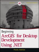
Get the very most out of the Arc GIS for Desktop products
through Arc Objects and .NET
Arc GIS for Desktop is a powerful suite of software tools for
creating and using maps, compiling, analyzing and sharing
geographic information, using maps and geographic information in
applications, and managing geographic databases. But getting the
hang of Arc GIS for Desktop can be a bit tricky, even for
experienced programmers. Core components of Arc GIS platform is
called Arc Objects. This book first introduce you the whole Arc GIS
platform and the opportunities for development using various
programming languages. Then it focuses on Arc GIS for Desktop
applications and makes you familiar with Arc Objects from .NET point
of view. Whether you are an Arc GIS user with no background in
programming or a programmer without experience with the Arc GIS
platform, this book arms you with everything you need to get going
with Arc GIS for Desktop development using .NET?right away. Written
by a leading expert in geospatial information system design and
development, it provides concise, step-by-step guidance,
illustrated with best-practices examples, along with plenty of
ready-to-use source code. In no time you?ll progress from .NET
programming basics to understanding the full suite of Arc GIS tools
and artefacts to customising and building your own commands, tools
and extensions?all the way through application deployment.
Among other things, you?ll learn to:
* Object-Oriented and Interface-based programming in .NET (C# and
VB.NET)
* Finding relationship between classes and interfaces using
object model diagrams
* Querying data
* Visualizing geographical data using various rendering
* Creating various kinds of Desktop Add-Ins
* Performing foreground and background geoprocessing
Learn how to improve your productivity with Arc GIS for
Desktop and Beginning Arc GIS for Desktop Development Using
.NET
เกี่ยวกับผู้แต่ง
Pouria Amirian holds a Ph.D. of Geospatial Information Systems (GIS). Dr. Amirian is a developer and GIS/IT lecturer with extensive experience developing and deploying small to large-scale Geospatial Information Systems.
Wrox Beginning guides are crafted to make learning programming languages and technologies easier than you think, providing a structured, tutorial format that guides you through all the techniques involved.


