Matthew W. Wilson is an assistant professor in the Department of Geography at the University of Kentucky and a visiting scholar at the Center for Geographic Analysis at Harvard University. He co-founded and co-directs the New Mappings Collaboratory which studies and facilitates new engagements with geographic representation. His research in critical GIS draws upon STS and urban political geography to understand the development and proliferation of location-based technologies, with particular attention to the consumer electronic sector. He has previously taught at the Harvard Graduate School of Design, and his current research project focuses on the founding of the Laboratory for Computer Graphics at Harvard in 1965, a catalyzing moment in the advent of the digital map. His work has been published in leading journals and collections including, Society & Space, Landscape & Urban Planning, Geoforum, The Professional Geographer, Annals of the Association of American Geographers, Cartographica, Social & Cultural Geography, Gender, Place & Culture, and Environment & Planning A.
5 หนังสืออิเล็กทรอนิกส์โดย Tracey P. Lauriault
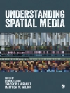
Rob Kitchin & Tracey P. Lauriault: Understanding Spatial Media
Over the past decade, a new set of interactive, open, participatory and networked spatial media have become widespread. These include mapping platforms, virtual globes, user-generated spatial d …
EPUB
อังกฤษ
DRM
€54.99
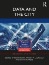
Rob Kitchin & Tracey P. Lauriault: Data and the City
There is a long history of governments, businesses, science and citizens producing and utilizing data in order to monitor, regulate, profit from and make sense of the urban world. Recently, we have e …
EPUB
อังกฤษ
DRM
€56.47
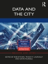
Rob Kitchin & Tracey P. Lauriault: Data and the City
There is a long history of governments, businesses, science and citizens producing and utilizing data in order to monitor, regulate, profit from and make sense of the urban world. Recently, we have e …
PDF
อังกฤษ
DRM
€56.54
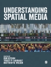
Rob Kitchin & Tracey P. Lauriault: Understanding Spatial Media
Over the past decade, a new set of interactive, open, participatory and networked spatial media have become widespread. These include mapping platforms, virtual globes, user-generated spatial databas …
PDF
อังกฤษ
DRM
€51.35
Tracey Lauriault & D.R. Fraser Taylor: Cybercartography
For generations, the map has been central to how societies function all over the world. Cybercartography is a new paradigm for maps and mapping in the information era. Defined as "the organizati …
PDF
อังกฤษ
DRM
€187.54
