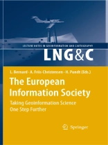
The Association of Geographic Information Laboratories for Europe (AGILE) was established in early 1998 to promote academic teaching and research on GIS at the European level. AGILE seeks to ensure that the views of the geographic information teaching and research community are fully represented in the discussions that take place on future European – search agendas and it also provides a permanent scientific forum where geographic information researchers can meet and exchange ideas and – periences at the European level. In 2007 AGILE provided – for the first time since its existence – a book constituting a collection of scientific papers that were submitted as fu- papers to the annual AGILE conference and went through a competitive and thorough review process. Published in the Springer Lecture Notes in Geoinformation and Cartography this first edition was well received within AGILE and within the European Geoinformation Science com- nity as a whole. Thus, the decision was easily made to establish a Springer th Volume for the 11 AGILE conference held 2008 in Girona, Spain, and led to what you now hold in your hands.
İçerik tablosu
Forest Stand Volume of Sitka Spruce Plantations in Britain: Can Existing Laser Scanning Methods Based on the Conventional One Provide Better Results, a Comparison of Two Approaches.- Assessing Stand and Data Variability Using Airborne Laser Scanner.- Model Based Optimization of Mobile Geosensor Networks.- Evaluation of the Geometric Accuracy of Automatically Recorded 3D – City Models Compared to GIS-Data.- Lifting Imprecise Values.- Geo SR: Geographically Explore Semantic Relations in World Knowledge.- A Study on the Cognitive Plausibility of SIM-DL Similarity Rankings for Geographic Feature Types.- A Geospatial Implementation of a Novel Delineation Clustering Algorithm Employing the K-means.- DBSCAN-MO: Density-Based Clustering among Moving Obstacles.- A Metric of Compactness of Urban Change Illustrated to 22 European Countries.- Advanced Data Mining Method for Discovering Regions and Trajectories of Moving Objects: “Ciconia Ciconia” Scenario.- Mining Spatio-Temporal Data at Different Levels of Detail.- Automated Boundary Creation: Atomic Small Areas in Ireland.- Climate-Change Adaptations in Land-Use Planning; A Scenario-Based Approach.- Quantifying and Analysing Neighbourhood Characteristics Supporting Urban Land-Use Modelling.- Interactive Multi-Perspective Views of Virtual 3D Landscape and City Models.- Scenario-Based Spatial Decision Support for Network Infrastructure Design.- Grouping of Optimized Pedestrian Routes for Multi-Modal Route Planning: A Comparison of Two Cities.- Spatial Decision Support in the Pedagogical Area: Processing Travel Stories to Discover Itineraries Hidden Beneath the Surface.- Ownership Definition and Instances Integration in Highly Coupled Spatial Data Infrastructures.- Spatial Data Integrability and Interoperability in the Contextof SDI.- Information Services to Support Disaster and Risk Management in Alpine Areas.- User Performance in Interaction with Web-GIS: A Semi-Automated Methodology Using Log-Files and Streaming-Tools.
