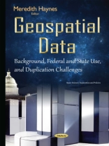
The federal government collects, maintains, and uses geospatial information-data linked to specific geographic locations-to help support varied missions, including national security and natural resources conservation. To coordinate geospatial activities, in 1994 the President issued an executive order to develop a National Spatial Data Infrastructure-a framework for coordination that includes standards, data themes, and a clearinghouse. This book describes the geospatial data that selected federal agencies and states use and how much is spent on geospatial data; assess progress in establishing the National Spatial Data Infrastructure; and determine whether selected federal agencies and states invest in duplicative geospatial data.
Придбайте цю електронну книгу та отримайте ще 1 БЕЗКОШТОВНО!
Формат PDF ● Сторінки 193 ● ISBN 9781634835329 ● Редактор Meredith Haynes ● Видавець Nova Science Publishers ● Опубліковано 2015 ● Завантажувані 3 разів ● Валюта EUR ● Посвідчення особи 7226074 ● Захист від копіювання Adobe DRM
Потрібен читач електронних книг, що підтримує DRM
