Whilst the greatest effort has been made to ensure the quality of this text, due to the historical nature of this content, in some rare cases there may be minor issues with legibility. The Colorado Plateaus extend from southern Wyoming through western Colorado and eastern Utah far into New Mexico and Arizona. They are bounded on the north by the Wind River and Sweetwater Mountains, on the east by the Park Mountains, on the south by the Desert Range Region, and on the west by the Basin Range Region.<br><br>The Plateaus are chiefly drained by the Colorado River, but a small area on the northwest is drained into Shoshone River, another on the northeast into the Platte River, still another on the southeast into the Rio Grande del Norte, and finally the western margin is drained by the upper portions of the Sevier, Provo, Ogden, Weber, and Bear Rivers. The general elevation is about 7, 000 feet above the level of the sea – varying from 5, 000 to 12, 000 feet. The ascent from the low, desert plains on the south is very abrupt – in many places by a steep and almost impassable escarpment. In the Plateau Province an extensive series of sedimentary formations appear, embracing Paleozoic, Mesozoic, and Tertiary strata, but crystalline schists and granites are found in some of the deep canons.<br><br>A marked unconformity exists between the Silurian and Devonian rocks; another between the Devonian and Carboniferous; another, but not so well marked, between the Carboniferous and Mesozoic, and lastly an unconformity between Cretaceous and Tertiary is usually well defined. The Plateaus have been above the sea since the close of the Cretaceous period but during early Tertiary times extensive lakes existed throughout the Province.
Clarence E. Dutton
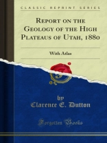
Report on the Geology of the High Plateaus of Utah, 1880 [PDF ebook]
With Atlas
Report on the Geology of the High Plateaus of Utah, 1880 [PDF ebook]
With Atlas
购买此电子书可免费获赠一本!
语言 英语 ● 格式 PDF ● ISBN 9780259634065 ● 出版者 Forgotten Books ● 发布时间 2019 ● 下载 3 时 ● 货币 EUR ● ID 5474360 ● 复制保护 Adobe DRM
需要具备DRM功能的电子书阅读器


