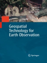
Earth Observation interacts with space, remote sensing, communication, and information technologies, and plays an increasingly significant role in Earth related scientific studies, resource management, homeland security, topographic mapping, and development of a healthy, sustainable environment and community.
Geospatial Technology for Earth Observation provides an in-depth and broad collection of recent progress in Earth observation. Contributed by leading experts in this field, the book covers satellite, airborne and ground remote sensing systems and system integration, sensor orientation, remote sensing physics, image classification and analysis, information extraction, geospatial service, and various application topics, including cadastral mapping, land use change evaluation, water environment monitoring, flood mapping, and decision making support.
Geospatial Technology for Earth Observation serves as a valuable training source for researchers, developers, and practitioners in geospatial science and technology industry. It is also suitable as a reference book for upper level college students and graduate students in geospatial technology, geosciences, resource management, and informatics.
Spis treści
An Overview of Earth Observation and Geospatial Information Service.- A UAV Remote Sensing System: Design and Tests.- Design and Applications of an Integrated Multi-Sensor Mobile System for Road Surface Condition Detection.- High Resolution Satellite Image Orientation Models.- Geometric Processing Models For Remotely Sensed Imagery And Their Accuracy Assessment.- Mapping High-Resolution Land Surface Radiative Fluxes from MODIS: Algorithms and Preliminary Validation Results.- Spectral Information Content of Remote Sensing Imagery.- Algorithms and Applications for Land Cover Classification #x2013; A Review.- Analysis of Hyperspectral Remote Sensing Images.- Effects of Aggregation Methods on Image Classification.- Towards Automation of Information Extraction from Aerial and Satellite Images.- Efficient Geospatial Analysis of Remotely Sensed Images by Means of Linear Feature Extraction and Combination.- Geospatial Service Web.- Optimal Composition Algorithm Concerned with Response Time for Remotely Sensed Image Processing Services.- Cadastral Mapping with Earth Observation Technology.- Spatio-Temporal Pattern Analysis of Land Cover Change: A Case Study in Aridzone.- Remote Sensing of Water Environment.- Flood Mapping and Damage Assessment #x2013; A Case Study in the State of Indiana.- Decision Making Based on Earth Observation Technology.
