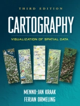
Integrating cutting-edge technology with traditional cartographic principles, this text provides a framework for effectively visualizing and analyzing geospatial data. It gives students critical concepts and methods for harnessing the enormous amount of geospatial data that is available on the Internet and creating maps that can support real-world decision making. The writing style is straightforward and accessible. Illustrated throughout with highly instructive diagrams and sample maps, the book includes 58 color plates.
Achetez cet ebook et obtenez-en 1 de plus GRATUITEMENT !
Langue Anglais ● Format PDF ● Pages 199 ● ISBN 9781609181949 ● Maison d’édition Guilford Publications ● Publié 2011 ● Téléchargeable 3 fois ● Devise EUR ● ID 6634154 ● Protection contre la copie Adobe DRM
Nécessite un lecteur de livre électronique compatible DRM


