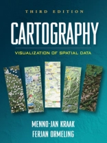
Integrating cutting-edge technology with traditional cartographic principles, this text provides a framework for effectively visualizing and analyzing geospatial data. It gives students critical concepts and methods for harnessing the enormous amount of geospatial data that is available on the Internet and creating maps that can support real-world decision making. The writing style is straightforward and accessible. Illustrated throughout with highly instructive diagrams and sample maps, the book includes 58 color plates.
Mua cuốn sách điện tử này và nhận thêm 1 cuốn MIỄN PHÍ!
Ngôn ngữ Anh ● định dạng PDF ● Trang 199 ● ISBN 9781609181949 ● Nhà xuất bản Guilford Publications ● Được phát hành 2011 ● Có thể tải xuống 3 lần ● Tiền tệ EUR ● TÔI 6634154 ● Sao chép bảo vệ Adobe DRM
Yêu cầu trình đọc ebook có khả năng DRM


