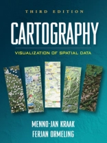
Integrating cutting-edge technology with traditional cartographic principles, this text provides a framework for effectively visualizing and analyzing geospatial data. It gives students critical concepts and methods for harnessing the enormous amount of geospatial data that is available on the Internet and creating maps that can support real-world decision making. The writing style is straightforward and accessible. Illustrated throughout with highly instructive diagrams and sample maps, the book includes 58 color plates.
购买此电子书可免费获赠一本!
语言 英语 ● 格式 PDF ● 网页 199 ● ISBN 9781609181949 ● 出版者 Guilford Publications ● 发布时间 2011 ● 下载 3 时 ● 货币 EUR ● ID 6634154 ● 复制保护 Adobe DRM
需要具备DRM功能的电子书阅读器


